After the successful introduction of the new dashboard and the simplified handling of the O-Editor, I could now continue to work on the actual base, the map data. The goal was to get a detailed display with many new symbols and to make all objects editable. Furthermore I am looking for sponsors and donations to continue the project. In the following article I will talk about several of these upcoming changes.
Large changes of the map data
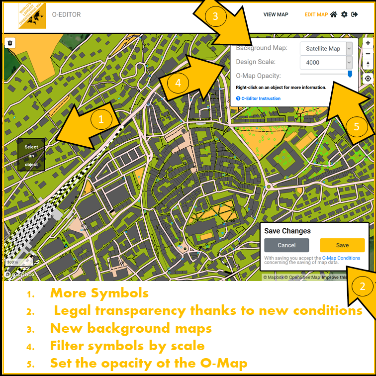
After the release of the heatmap, which shows in which countries the O-Map is used, I realized that the O-Map is used in many more countries than I thought. In order to provide all users with as good map data as possible, I changed the plan and started to increasingly access worldwide data collections, so that the O-Map is provided as equally as possible in high resolution. The OpenstreetMap data, which are specially prepared for this purpose, are particularly suitable for this. However, since the orienteering map differs significantly from other common maps such as Google Maps and so on, each object had to be sorted, designed and recorded individually. This process is very time consuming and especially the control of special situations, such as multi-story levels is sometimes an impossibility. This is the curse of automation, because what is wanted is an algorithm that takes into account as many of these special cases as possible. It is not possible to cover all situations, in some cases manual help is needed. This will be possible in the new O-Editor. Work is continuing to capture and enter new objects.
This new process, to make the map more detailed, is much more complex and thus requires much more power. Therefore the control in the map viewer had to be adapted. Map sections that are viewed at a scale of 1:15,000 and larger take some time to load. It is comparable to opening 100 different web pages on the device at the same time. This is because in order for the map objects to be displayed, the O-Map website calls up many different other maps and collects those objects that are to be displayed in the current parameter. After that, these objects are compared to prevent some objects from being displayed twice. Later, they are compared with the O-Map database to check if a user has modified the object. This process now allows all objects to be edited. As already mentioned, this process takes some time. In some cases, for example when a larger city is viewed at a scale of 1:15,000, this is then too much and the map data cannot be loaded completely. In such a parameter, 5'000-10'000 objects are quickly collected and compared. In this situation, it is necessary to switch to a larger scale so that the map can be displayed correctly.
 )
)
Terrain data
More and more countries are making their terrain models available on the Internet. With the help of complex calculations, the elevation curve data for the O-Map can be obtained from it. Even further, it would even be possible to extract individual point objects such as hilltops, holes, etc. This process is being planned for various countries.
New programs to follow
Now we dare another look into the future. The O-Manager, an online orienteering course setting program, is in its final phase. The program allows to lay complex courses on the O-Map in a team. For this purpose, a map parameter can be exported and saved. On this parameter, as in other course setting programs, courses, categories and so on can be defined and thus the courses for a training or competition can be set. The O-Manager will also be fully available on the smartphone in the internet browser. Details of the O-Manager and its launch will be communicated in time. Subscribe to the newsletter to be notified of changes.
Finally, I would like to thank all users. Only with your suggestions and ideas it is possible to build such a project. Your positive feedback makes me very happy and encourages me to further improve the O-Map. The maintenance of such a website, especially if it needs a lot of computing power, is expensive. That's why I'm looking for sponsors to finance the project and thus push the further development. On the website an individual contribution can be donated via PayPal. For sponsorships you are welcome to contact me at info@o-map.ch. I already thank you for your donation, which will help the O-Map to move forward. Thank you!
I am looking forward to the upcoming time and would appreciate a short message from you what your thoughts are about the upcoming features.
Andrin Benz info@o-map.ch